Difference between revisions of "Avenue"
C-tompkins (talk | contribs) |
C-tompkins (talk | contribs) |
||
| Line 59: | Line 59: | ||
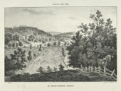
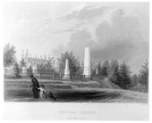
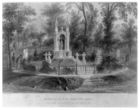
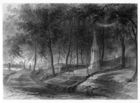
Image:1074.jpg|[[James Smillie]] (artist), O.J. Hanks (engraver), “View of the Naval Monument (Central Avenue), Mount Auburn Cemetery," in Cornelia W. Walter, ''Mount Auburn Illustrated'' (1850 [1847]), opp. p.22. | Image:1074.jpg|[[James Smillie]] (artist), O.J. Hanks (engraver), “View of the Naval Monument (Central Avenue), Mount Auburn Cemetery," in Cornelia W. Walter, ''Mount Auburn Illustrated'' (1850 [1847]), opp. p.22. | ||
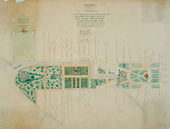
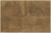
| − | Image:0023.jpg|[[A. J. Downing]], N. Michler (copied by), "Plan Showing Proposed Method of Laying Out the Public Grounds at Washington." Manuscript copy of Andrew Jackson Downing's plan for the Mall of 1851, 1867. | + | Image:1967.jpg|[[A.J. Downing]], "Plan showing proposed method of laying out the public grounds at Washington," 1851. Library of Congress, Washington, D.C. |
| + | |||
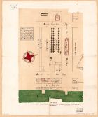
| + | Image:0023.jpg|[[A.J. Downing]], N. Michler (copied by), "Plan Showing Proposed Method of Laying Out the Public Grounds at Washington." Manuscript copy of Andrew Jackson Downing's plan for the Mall of 1851, 1867. | ||
Revision as of 19:18, January 24, 2014
Discussion
As Noah Webster’s definition states, the word avenue signifies a passage and is rooted in the French word venir (L. vinio), to come or go.
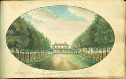
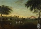
In landscape design an avenue, which was typically planted with trees, varied in scale from a walk to a wide street. From William Byrd II’s 1712 description of Williamsburg, Va., to Rev. Nehemiah Adams’s 1842 account of Boston Common, the avenue has figured prominently in the American designed landscape in a wide range of contexts. An avenue provided an approach to a house, as shown in Charles Fraser’s painting of Golden Grove in South Carolina [Fig. 1]. It served as a public roadway suited to the monumental scale of a governor’s palace, a Native American mound, or a domed capitol. Avenues were also common elements of gardens, public parks, and cemeteries, where they became popular settings for promenades and elegant carriage drives.
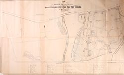
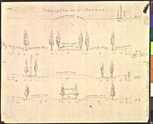
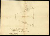
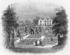
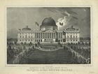
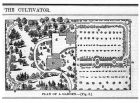
. Treatises such as Batty Langley’s New Principles of Gardening (1728) and George William Johnson’s Dictionary of Modern Gardening (1847) extolled the benefits of avenues and emphasized the importance of designing them in relative proportion to surrounding architecture. Images of Pennsylvania Avenue in Washington, D.C. [Fig. 2], and Thomas S. Sinclair’s plan of the Pennsylvania Hospital for the Insane in Philadelphia [Fig. 3] illustrate the variety of American avenues from urban roadways to garden walkways, as well as their corresponding shifts in scale. One of the key characteristics distinguishing avenues from other circulation routes (such as the alley, or path, and road, street, and walk) was their relative size (see Alley and Walk).
Bernard M’Mahon noted in his 1806 treatise that avenues in gardens require “some spacious open space,” and Joseph Holt Ingraham’s 1835 description of a plantation along the Mississippi River differentiated between the broad main avenue and the branching narrower walks. The construction of avenues varied; descriptions mention surfaces of dirt, cobblestone, gravel, and brick. In 1829 the New England Farmer described an avenue in Albany, N.Y., as “McAdamized in the true English style.” The planting of avenues also varied depending on their context. As Ephraim Chambers’ 1741–43 definition suggests, tree plantings were an essential element of an avenue, accentuating its scale and reinforcing its role in directing the gaze. M’Mahon similarly commented in 1806 on the relative merits of deciduous and evergreen trees for avenue plantings. In the warmer climes, trees such as lemon, orange, live oak, and palm were planted along avenues, while in the mid-Atlantic poplar, cherry, lime [or linden], and cedar were popular choices. New England descriptions mention linden, larch, maple, elm, locust, and chestnut trees. A. J. Downing recommended elms, plane trees, horse chestnuts, maples, and tulip trees for avenues. While the spreading branches, such as those described by Adams on Boston Common in 1842, created “ancient shade” and alluded to Gothic architecture, tall narrow trees such as poplar and palm enhanced the straight vistas that avenues created. As David Bailie Warden complained of Washington, D.C., in 1816, however, this vegetation offered little relief from the oppressive heat.
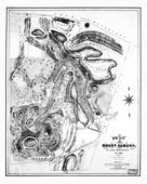
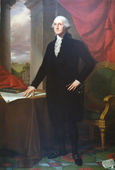
Avenues were typically planted with trees on both sides in single or double rows, although, as Samuel Deane (1790) noted, trees might also be planted on only one side. In contrast to straight rows of trees, Philip Miller (1759) recommended planting avenues in clumps, or as The Complete Farmer (1769) identified them, “platoons,” of seven or nine trees grouped at intervals of 300 feet. Clumped plantings were extolled further by Thomas Whately, who advocated in 1770 that the “modern” winding avenue should be used as an approach to a house because it “commands two sides at once, and throws them both into perspective.” This style of winding avenues and clumped plantings was rarely employed in America until the 1830s and 1840s, when more naturalistic designs can be seen at Mount Auburn Cemetery, and later in 1850 at Mrs. Pratt’s residence in Boston. One early exception was the redesign of the garden at Mount Vernon in the 1780s, in which Washington used serpentine avenues for the approach to the house and planted shrubberies and wildernesses in the bends of the roadway.[1]
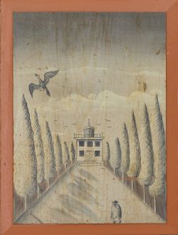
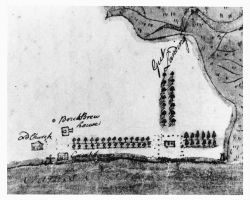
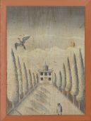
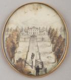
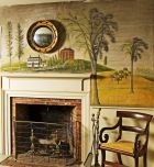
Despite Whately’s criticism that straight avenues have “a tedious sameness” and the buildings to which they are “appropriated . . . [are] seldom shewn to advantage,” most American descriptions praised the effect of tree-lined avenues in directing one’s view to a terminal point. George William Johnson’s 1847 discussion of “Avenue” explains how this effect is achieved as the avenue “cuts the scenery directly in two, and reduces all the prospect to a narrow vista.” Such adjectives as “elegant,” “grand,” “noble,” and “handsome” were used repeatedly in descriptions of avenues framing a house, such as that at Nomini Hall in Westmoreland County, Va., which was described in 1774 by Philip Vickers Fithian. The painted door panels of the Thaxter- Lincoln house in Hingham, Mass. [Fig. 4], illustrate this framing effect, as do John Mason’s recollections (c. 1830) of his father’s avenue at Gunston Hall, Va., with its double rows of black heart cherry trees on either side. Jean de La Quintinie (1693) described avenues as “more properly leading to the front of Houses,” and some of the earliest landscaping in Virginia was the construction of avenues aligned with houses’ central axes, as in William Byrd II’s description of the Governor’s Palace at Williamsburg (1712), or seen on the 1701 plan of his own estate of Westover [Fig. 5].
Through the mid-nineteenth century, travelers in the South admired plantation dwelling houses fronted by straight, shaded avenues arched with mature live oaks. It is also interesting to note that despite treatise writers’ repeated assertions that avenues were becoming less fashionable, visitors continued to admire plantings of stately trees, and homeowners, such as Henry Wadsworth Longfellow, still planted avenues in the 1840s. Their lasting visual appeal and the legacy of mature trees have made avenues an enduring element of American design despite shifts in gardening styles.
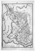
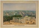
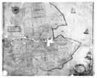
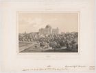
Urban avenues—created by designers such as Francis Nicholson in Williamsburg; in Annapolis [Fig. 6], and, possibly, in St. Mary’s City, Md.; and Thomas Jefferson and Pierre- Charles L’Enfant in Washington, D.C. [Fig. 7]—were direct imports of eighteenth-century urban design principles.[2] Thomas Twining’s 1796 account of Washington in the early stages of construction detailed how, from the avenues clear cut through the woods, he knew he was in a “metropolitan city.” The imagery of avenues cut through America’s abundant woodlands as a sign of advancing civilization was echoed as late as 1844 in a report about Rochester, N.Y., in the Magazine of Horticulture. The width and unbroken length in American avenues were not only reminiscent of European models, but the feature also carried the same connotations of authority, monumentality, and status. Such a form, which did not deviate for any obstacle, suggested enormous resources and power. The convergence of avenues on a single point, as with the U.S. Capitol depicted in Robert P. Smith’s 1850 view of Washington, D.C. [Fig. 8], reinforced the centrality of the monument and the authority that it represented by controlling both sight lines and movement within the urban fabric. Whether a visiting diplomat, a parading soldier, or protesting citizen, those who experienced the broad swath of Pennsylvania Avenue leading to the domed capitol had no doubt as to the central authority of the city and the nation that it represented. The scale of avenues also made them suited for larger landscape designs of institutional grounds, where they provided shaded walkways and directed views toward significant structures. Examples include the plan for the University of North Carolina of 1795 [Fig. 9] and the plan for the University of Michigan of 1838 [Fig. 10].
-- Elizabeth Kryder-Reid
Images
Inscribed
Batty Langley, "Design of a rural Garden, after the new manner", in New Principles of Gardening (1728), pl. III, opp. p. 208.
Andrew Ellicott (creator), Samuel Hill (engraver), "Plan of the City of Washington in the territory of Columbia," 1792.
Charles W. Harris, "A plan of the situation of ye University, ye ornamental ground, ye adjacent village, the lands belonging to ye trustees together with ye springs," 1795.
Nicholas King, Section of Thomas Jefferson's Design for "Pennsylvania Avenue," 1803.
Benjamin Henry Latrobe, Plan of the Capitol grounds, 1815.
Jacques-Gerard Milbert (artist), Formentin (printer of plates), State of New-York. Mc.Comb's Bridge Avenue, c.1819.
Charles Bulfinch, "Plan of Grounds adjacent to the United States Capitol," 1822.
Robert Mills, "Plan of the Washington Canal," 1831.
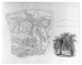
Alexander Wadsworth, Plan of Mount Auburn Cemetery, 1831.
Henry Schenck Tanner, "City of Washington," c.1836.
Alexander Jackson Davis, Design for University of Michigan (elevation and plan of building and grounds), c.1838.
Robert Mills, "Plan of the Mall," 1841.
James Smillie (artist), Robert Hinshelwood (engraver), "Bay-Side Avenue, Fern Hill," in Nehemiah Cleaveland, Green-wood Illustrated (1847), opp. p.42.
James Smillie, "Greenwood Cemetery," in Nehemiah Cleaveland, Green-wood Illustrated (1847), flyleaf.
James Smillie, “Mount Auburn Cemetery," in Cornelia W. Walter, Mount Auburn Illustrated (1850 [1847]), frontispiece.
James Smillie (artist), O.J. Hanks (engraver), “View of the Naval Monument (Central Avenue), Mount Auburn Cemetery," in Cornelia W. Walter, Mount Auburn Illustrated (1850 [1847]), opp. p.22.
A.J. Downing, "Plan showing proposed method of laying out the public grounds at Washington," 1851. Library of Congress, Washington, D.C.
A.J. Downing, N. Michler (copied by), "Plan Showing Proposed Method of Laying Out the Public Grounds at Washington." Manuscript copy of Andrew Jackson Downing's plan for the Mall of 1851, 1867.
Associated
James E. Teschemacher, "A green-house constructed at the centre of a cottage," n.d.
Edward Penington (artist), William Fletcher Boogher, "A description of two lotts in the city of Philadelphia..." [detail], 1882 [1698].
Pierre-Charles L'Enfant, "Plan of the City intended for the Permanent Seat of the Government of the United States . . . ," 1791.
Pierre Pharoux, Plan for Esperanza (Speranza), 1794-95.
Andrew Ellicott, "Plan of the City of Washington in the Territory of Columbia," 1795.
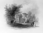
Anne-Marguerite-Henriette Rouillé de Marigny Hyde de Neuville, View of the Pennsylvania Avenue Gateway to the Grounds of the President's House, 1818.
Charles Burton, View of the United States Capitol along Pennsylvania Avenue, Washington, D.C., 1824.
J.C. Loudon, Avenues, in An Encyclopaedia of Gardening (1826), p.943, fig.630a-f.
John Smith Rubens, View of Pennsylvania Avenue to the White House from the Capitol, 1834.
John Vanderlyn, George Washington, 1834.
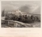
W. H. Bartlett, "Washington from the President's House," in Nathaniel Parker Willis, American scenery; or, Land, lake and river illustrations of transatlantic nature, Vol II (1840), opp. p.50.
Thomas Doughty, View of the Capitol, c.1840-1850.
Alexander W. Longfellow, Sketch of the Grounds of the Longfellow Estate, 1844.
James Smillie (artist), John A. Rolph (engraver), "Indian Mound," in Nehemiah Cleaveland, Green-wood Illustrated (1847), opp. p.19.
James Smillie, "Bay-Grove Hill," in Nehemiah Cleaveland, Green-wood Illustrated (1847), opp. p.26.
James Smillie, "Lawn-Girt Hill," in Nehemiah Cleaveland, Green-wood Illustrated (1847), opp. p.61.
James Smillie (artist), W.W. Rice (engraver), "Monument to Miss Charlotte Canda," in Nehemiah Cleaveland, The Rural Cemeteries of America (1855 [1847]), opp. p.8.
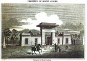
James Smillie, “Entrance to the Cemetery" [detail], in Cornelia W. Walter, Mount Auburn Illustrated (1850 [1847]), title page.
James Smillie (artist), John A. Rolph (engraver), “View of the Central Square, Mount Auburn Cemetery," in Cornelia W. Walter, Mount Auburn Illustrated (1850 [1847]), opp. p.61.
- 1067.jpg
James Smillie, “View of the Bowditch Monument, Mount Auburn Cemetery," in Cornelia W. Walter, Mount Auburn Illustrated (1850 [1847]), opp. p.105.
James Smillie (artist), Rice & Buttre (engravers), "View of Oxnard's Monument, Mount Auburn Cemetery" in Cornelia W. Walter, Mount Auburn Illustrated (1850 [1847]), opp. p.116.
Robert P. Smith, View of Washington, c.1850.
- 0620.jpg
Unknown, Elihu Hobart House, 1850.
Edward Sachse, View of Washington, 1852.
Attributed
James Stoddert, A ground plat of the city and port of Annapolis, copy of James Stoddert's map of 1718, 1718 [1743].
Christian Remick, A Prospective View of part of the Commons, c.1768.
Charles Willson Peale, Parnassus, c. 1769.
- 0246.jpg
Claude Joseph Sauthier, A "plan of the town and port of Brunswick, in Brunswick county, North Carolina; surveyed and drawn in April, 1769, by CJ Sauthier," on a scale of 45 fathoms to an inch., 1769.
Winthrop Chandler, Homestead of General Timothy Ruggles, Hardwick, Massachusetts, c.1770-1775.
Ludwig Gottfried von Redeken, A View of Salem in N. Carolina-1787, 1787.
Jonathan Buddington, View of the Cannon House and Wharf, 1792.
Ralph Earl, Captain John Pratt (1753-1824), 1792.
William Clarke, Mrs. Levin Winder (Mary Stoughton Sloss), 1793.
Pierre Pharoux, Aerial View of Park(?), Esperanza, 1794-1795.
- 1296.jpg
Benjamin Henry Latrobe, "Sketch of the House of Mr. Francis Eps on the Appomattox," 1796.
Charles Fraser, "Another View of the Same," 1803.
Francis Guy, Perry Hall from the northwest, c.1805.
George Ropes, Salem Common on Training Day, 1808.
Charles Fraser, "Golden Grove, The Seat of Mrs. Sommers--Stono," 1810.
Benjamin Henry Latrobe, U.S. Capitol and Pennsylvania Avenue before 1814, c.1814-1820.
Joseph Jacques Ramée (artist), J. Klein and V. Balch (engravers), "View of Union College in the City of Schenectady," c.1820.
Rufus Porter and J.D. Poor, Josiah Stone House [also known as the Holsaert House/Cobb House], 1825-1830.
Anthony St. John Baker, "View of the White House," 1826, in Mémoires d’un voyageur qui se repose (1850).
- 0109.jpg
J. B. Neagle, View from the Capitol to the White House along Pennsylvania Avenue, 1834.
William A. Pratt (artist), Charles Fenderich (lithographer), "Elevation of the eastern front of the Capitol of the United States," c.1839.
John J. Thomas, "Plan of a Garden," in The Cultivator 9, no. 1 (Jan. 1842), p.22, fig.8.
Augustus Köllner, "Capitol (west side)," c.1850.
Texts
Common Usage
- Byrd, William, II, 2 February 1712, describing a visit to the Governor’s Palace, Williamsburg, Va. (Colonial Williamsburg Foundation; hereafter CWF)
- “About 11 o’clock I went to see the Governor’s avenue and his great house which pleased him.”
- Anonymous, 1737, describing in the Executive Journals of the Council of Colonial Virginia the proposed improvements to the Governor’s Palace, Williamsburg, Va. (quoted in Lounsbury 1994: 15) [3]
- “Ordered that there be paid to Mr. Philip Finch the sum of ten pounds for laying and planting the Avenue to the Governors House.”
- Pinckney, Eliza Lucas, 1743, in a letter to Miss Bartlett, describing Charleston, S.C. (1972: 62) [4]
- “I . . . cant say one word on the other seats I saw in this ramble, except the Count’s large double row of Oaks on each side the Avenue that leads to the house—which seemed designed by nature for pious meditation and friendly converse.”
- Callender, Hannah, 1762, describing Belmont Mansion, estate of Judge William Peters, near Philadelphia, Pa. (Pennsylvania Magazine of History and Biography 12: 455) [5]
- “A broad walk of English cherry trees leads down to the river. . . . One avenue gives a fine prospect of the City. . . . Another avenue looks to the obelisk.”
- Contemporary Observer [pseud.], 1767, describing the William Trent House, Trenton, N.J. (quoted in Dillon 1987b: 145B) [6]
- “a genteel brick dwelling house . . . with a large handsome staircase and entry . . . a large handsome avenue of English cherry trees.”
- Finlay, Hugh, 2 January 1774, describing a journey through South Carolina (CWF)
- “now and then we see a swamp, consequently a rice plantation . . . we came sometimes to avenues leading from the high road terminated by a farm houses at a quarter, half and sometimes three quarters of a mile distant.”
- Fithian, Philip Vickers, 18 March 1774, describing Nomini Hall, Westmoreland County, Va. (1943: 108–9) [7]
- “Due East of the Great House are two Rows of tall, flourishing, beautiful, Poplars, beginning on a Line drawn from the School to the Wash-House; these Rows are something wider than the House, & are about 300 yards Long, at the Eastermost end of which is the great Road. . . . These Rows of Poplars form an extremely pleasant avenue, & at the Road, through them, the House appears most romantic, at the same time that it does truly elegant.”
- Anonymous, 1778, describing in the South Carolina and American General Gazette a sale in Charleston, S.C. (quoted in Lounsbury 1994: 15) [3] back up to text
- “Magnolia or Laurels fit for Avenues . . . any height from three feet to twenty.”
- Washington, George, 21 March 1785, describing Mount Vernon, plantation of George Washington, Fairfax County, Va. (Jackson and Twohig, eds., 1978: 4:106) [8]
- “Staked up the largest of my Trees in the avenues and Wilderness and Shrubberies to day, which from the softness of the ground & impression made on them by the Wind were leaning.”
- Brissot de Warville, J. P., 1788, describing Mount Vernon, plantation of George Washington, Fairfax County, Va. (1792: 427–28) [9]
- “I hastened to arrive at Mount Vernon. . . . On this rout traverse a considerable wood, and after having passed over two hills, you discover a country house of an elegant and majestic simplicity. It is preceded by grassplats; on one side of the avenue are the stables, on the other a green-house, and houses for a number of negro mechanics.”
- Bartram, William, 1791, describing a residence on St. Simon’s Island, Ga. (1928: 71–72) [10]
- “Following an old highway, now out of repair, across the Savanna, I ascended the sloping green bank, and entered a noble forest of lofty pines, and then a venerable grove of Live Oaks, under whose shady spreading boughs opened a spacious avenue, leading to the former seat of general Oglethorpe, but now the property of capt. Raimond Demere. . . .
- “This delightful habitation was situated in the midst of a spacious grove of Live Oaks and Palms, near the strand of the bay, commanding a view of the inlet. A cool area surrounded the low but convenient buildings, from whence, through the groves, was a spacious avenue into the island, terminated by a large savanna; each side of the avenue was lined with bee-hives, to the number of fifty or sixty; they seemed to be well peopled, and exhibited a lively image of a colony that has attained to a state of power and affluence, by the practice of virtue and industry.”
- Bartram, William, 1791, describing Lake George, Ga. (1928: 101, 104) [10] back up to text
- “From this place we enjoyed a most enchanting prospect of the great Lake George, through a grand avenue, if I may so term this narrow reach of the river, which widens gradually for about two miles, towards its entrance into the lake, so as to elude the exact rules of perspective, and appears of an equal width. . . .
- “On the site of this ancient town, stands a very pompous Indian mount, or conical pyramid of earth, from which runs in a straight line a grand avenue or Indian highway, through a magnificent grove of magnolias, live oaks, palms, and orange trees, terminating at the verge of a large green level savanna.”
- L’Enfant, Pierre-Charles, 22 June 1791, in a report to George Washington describing L’Enfant’s plans for Washington, D.C. (quoted in Caemmerer 1950: 151) [11]
- “[I] made the distribution regular with streets at right angle north-south and east west but afterwards I opened others on various directions as avenues to and from every principal places, wishing by this not merely to contrast with the general regularity nor to afford a greater variety of pleasant seats and prospect as will be obtained from the advantageous ground over the which the avenues are mostly directed but principally to connect each part of the city with more efficacy by, if I may so express, making the real distance less from place to place in menaging on them a reisprocity of sight and making them thus seemingly connected promot a rapide stellement over the whole.”
- L’Enfant, Pierre-Charles, 4 January 1792, from notes on “Plan of the City” describing Washington, D.C. (quoted in Caemmerer 1950: 163–65)[11] back up to text
- “II. Lines or Avenues of direct communication have been devised, to connect the separate and most distant objects with the principal, and to preserve through the whole a reciprocity of sight at the same time. Attention has been paid to the passing of those leading avenues over the most favorable ground for prospect and convenience. . . .
- “Every Grand transverse Avenue, and every principal divergent one, such as the communication from the President’s House to the Congress House etc. are 160 feet in breadth and thus divided:
- 10 feet of pavement on each side . . . . . . 20
- 30 feet of gravel walk planted
- with trees on each side . . . . . . . . . . . . . . 60
- 80 feet in the middle for carriage way . . 80
- 160 feet. . . .
- “H. Grand Avenue, 400 feet in breadth, and about a mile in length, bordered with gardens, ending in a slope from the houses on each side. This Avenue leads to Monument A and connects the Congress Garden with the
- “I. President’s park and the
- “K. well-improved field.”
Citations
Notes
- ↑ Dennis J. Pogue, “Mount Vernon: Transformation of an Eighteenth-Century Plantation System,” in Historical Archaeology of the Chesapeake, ed. Paul A. Shackel and Barbara J. Little (Washington, D.C.: Smithsonian Institution Press, 1994), 101–14. Although Washington and J. P. Brissot de Warville referred to the roadways as “avenues,” other descriptions called them walks. view on Zotero
- ↑ John W. Reps, The Making of Urban America: A History of City Planning in the United States (Princeton, N.J.: Princeton University Press, 1965). For a discussion of the design of St. Mary’s City, Md., see Henry Miller, “Baroque Cities in the Wilderness: Archaeology and Urban Development in the Colonial Chesapeake,” Historical Archaeology 22, no. 2 (1988): 57–73. view on Zotero
- ↑ 3.0 3.1 Lounsbury, Carl R., ed. 1994. An Illustrated Glossary of Early Southern Architecture and Landscape. New York: Oxford University Press. view on Zotero
- ↑ Pinckney, Eliza Lucas. 1972. The Letterbook of Eliza Lucas Pinckney, 1739–1762. Edited by Elise Pinckney. Chapel Hill: University of North Carolina Press. view on Zotero
- ↑ Vaux, George. 1888. “Extracts from the Diary of Hannah Callender.” Pennsylvania Magazine of History and Biography 12 (1): 432–56. view on Zotero
- ↑ Dillon, Clarissa F. 1987. “‘A Large, an Useful, and a Grateful Field’: Eighteenth-Century Kitchen Gardens in Southeastern Pennsylvania, the Uses of the Plants, and Their Place in Women’s Work”. Ph.D. diss., Bryn Mawr College. view on Zotero
- ↑ Fithian, Philip Vickers. 1943. Journal & Letters of Philip Vickers Fithian, 1773-1774: A Plantation Tutor of the Old Dominion. Edited by Hunter D. Farish. Williamsburg, Va.: Colonial Williamsburg. view on Zotero
- ↑ Jackson, Donald, and Dorothy Twohig, ed. 1976. The Diaries of George Washington. 6 vols. Charlottesville, Va.: University Press of Virginia. view on Zotero
- ↑ Brissot de Warville, J.-P. (Jacques-Pierre). 1792. New Travels in the United States Performed in 1788. New York: T. & J. Swords. view on Zotero
- ↑ 10.0 10.1 Bartram, William. 1928. Travels through North and South Carolina, Georgia, East and West Florida. Edited by Mark Van Doren. New York: Dover. view on Zotero
- ↑ 11.0 11.1 Caemmerer, H. Paul. 1950. The Life of Pierre-Charles L’Enfant, Planner of the City Beautiful, The City of Washington. Washington, D.C.: National Republic. view on Zotero
