File:2265.jpg
[http://www.nga.gov/content/ngaweb/research/casva/research-projects.html A Project of the National Gallery of Art, Center for Advanced Study in the Visual Arts ]
Revision as of 16:12, August 25, 2020 by A-Whitlock (talk | contribs)
Size of this preview: 449 × 600 pixels. Other resolution: 3,475 × 4,641 pixels.
Original file (3,475 × 4,641 pixels, file size: 1.95 MB, MIME type: image/jpeg)
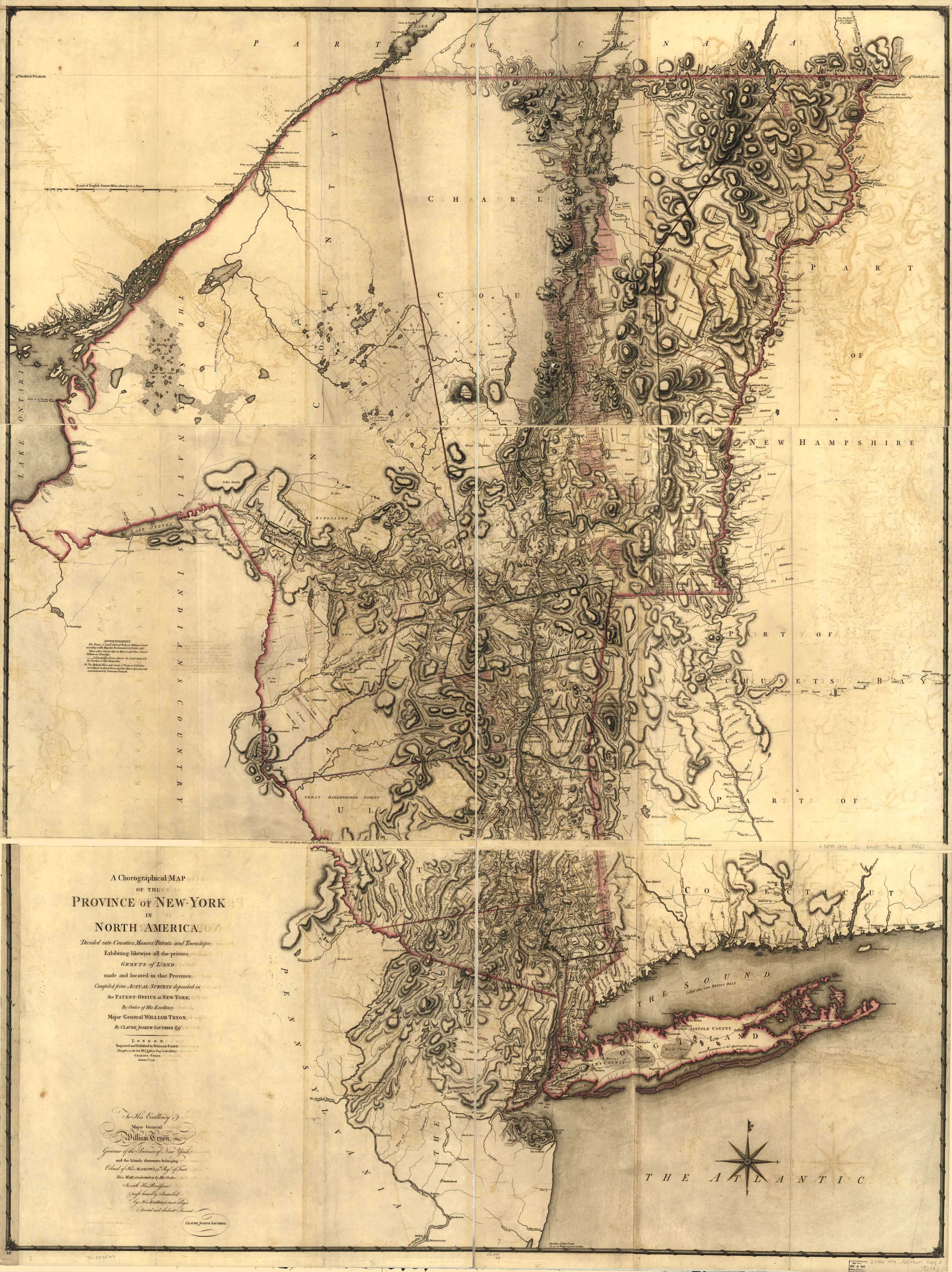
Claude Joseph Sauthier and William Faden, A chorographical map of the Province of New-York in North America, divided into counties, manors, patents and townships; exhibiting likewise all the private grants of land made and located in that Province, 1779. Map. Library of Congress Geography and Map Division Washington, D.C.
File history
Click on a date/time to view the file as it appeared at that time.
| Date/Time | Thumbnail | Dimensions | User | Comment | |
|---|---|---|---|---|---|
| current | 16:11, August 25, 2020 | | 3,475 × 4,641 (1.95 MB) | A-Whitlock (talk | contribs) |
You cannot overwrite this file.
File usage
The following page uses this file: