File:2237.jpg
[http://www.nga.gov/content/ngaweb/research/casva/research-projects.html A Project of the National Gallery of Art, Center for Advanced Study in the Visual Arts ]
Size of this preview: 448 × 600 pixels. Other resolution: 1,536 × 2,056 pixels.
Original file (1,536 × 2,056 pixels, file size: 1.48 MB, MIME type: image/jpeg)
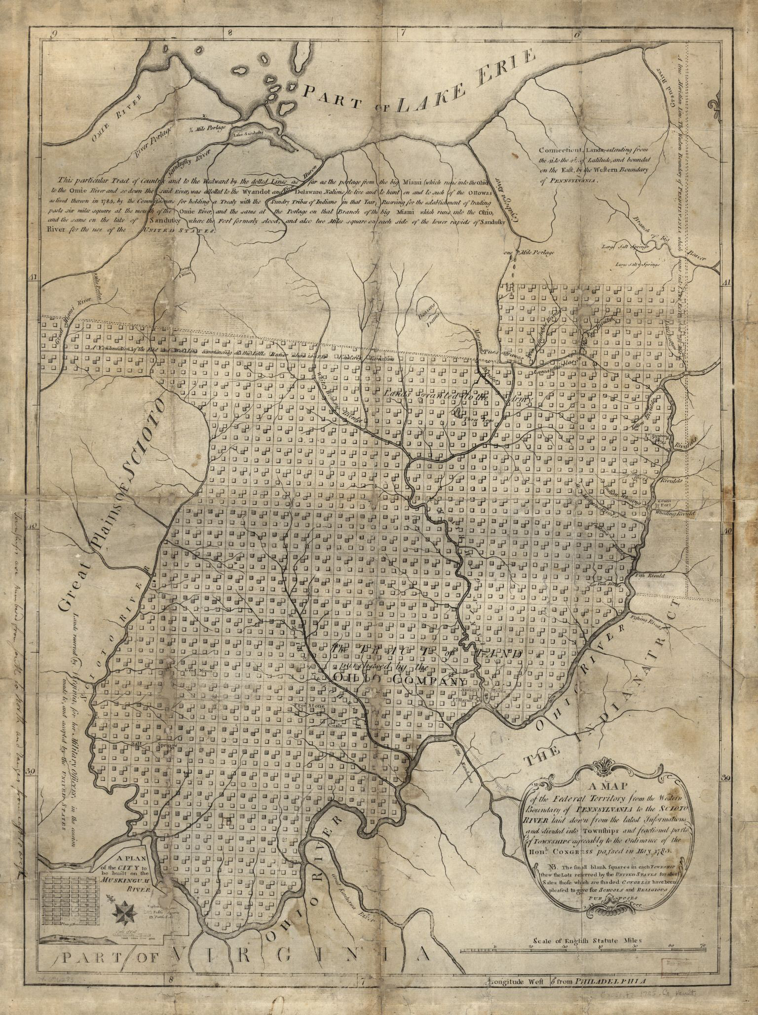
Manasseh Cutler, A map of the Federal Territory from the western boundary of Pennsylvania to the Scioto River, ca. 1785. Library of Congress Geography and Map Division Washington, DC.
File history
Click on a date/time to view the file as it appeared at that time.
| Date/Time | Thumbnail | Dimensions | User | Comment | |
|---|---|---|---|---|---|
| current | 20:11, January 6, 2020 | | 1,536 × 2,056 (1.48 MB) | A-Whitlock (talk | contribs) |
You cannot overwrite this file.
File usage
The following page uses this file: