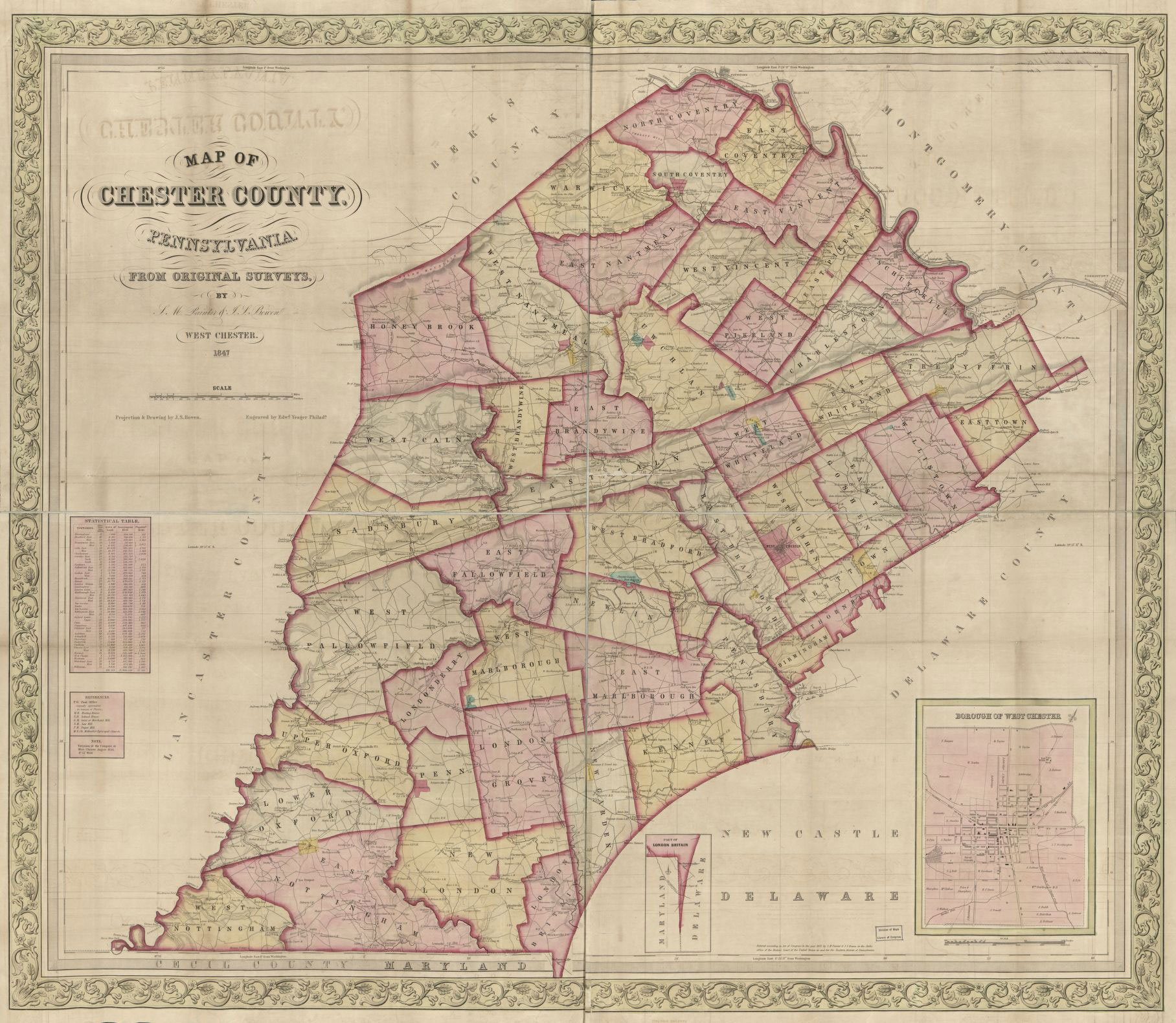
Edward Yeager after J. S. Bowen, Map of Chester County, Pennsylvania, 1847
[http://www.nga.gov/content/ngaweb/research/casva/research-projects.html A Project of the National Gallery of Art, Center for Advanced Study in the Visual Arts ]
File:2067.jpg /
Revision as of 18:28, September 7, 2021 by A-whitlock (talk | contribs)
Size of this preview: 689 × 600 pixels. Other resolution: 1,816 × 1,581 pixels.
Original file (1,816 × 1,581 pixels, file size: 672 KB, MIME type: image/jpeg)
About this image
Relationships
- Place
- Harmony Grove
- People
- Keyword relationships
Information
- Creator
- Edward Yeager after J. S. Bowen
- Date
- 1847
- Title
- Map of Chester County, Pennsylvania
- Inscription
- Map of/ Chester County, /Pensylvania./ From Original Surveys,/ By/ S. M. Painter & J. S. Bowen/ West Chester./ 1847/ Projection & Drawing by J. S. Bowen/ Engraved by Edwd. Yeager, Philada.
- Medium
- hand colored engraving
- Dimensions
- 37 2/5 x 44 1/10 in. (95 x 112 cm)
Reference
- Date of Publication
- Reference Title
- Volume
- Edition
- Page
- Figure
- Repository
- Zotero ID
Download an RDF export
Edward Yeager after J. S. Bowen, Map of Chester County, Pennsylvania, 1847, hand colored engraving, 37 2/5 x 44 1/10 in. (95 x 112 cm). Geography and Map Division, Library of Congress, Washington, DC.
Inscribed: Map of/ Chester County, /Pensylvania./ From Original Surveys,/ By/ S. M. Painter & J. S. Bowen/ West Chester./ 1847/ Projection & Drawing by J. S. Bowen/ Engraved by Edwd. Yeager, Philada.
File history
Click on a date/time to view the file as it appeared at that time.
| Date/Time | Thumbnail | Dimensions | User | Comment | |
|---|---|---|---|---|---|
| current | 14:12, March 3, 2016 | | 1,816 × 1,581 (672 KB) | C-tompkins (talk | contribs) | |
| 18:33, November 16, 2015 |  | 1,019 × 891 (184 KB) | R-Asleson (talk | contribs) | Edward Yeager after J. S. Bowen, ''Map of Chester County, Pennsylvania'', 1847, Library of Congress, Map Division, Washington, D.C.<p></p> Inscribed: Map of/ Chester County, /Pensylvania./ From Original Surveys,/ By/ S. M. Painter & J. S. Bowen/ West C... |
You cannot overwrite this file.
File usage
The following page uses this file: