Difference between revisions of "File:0880.jpg"
[http://www.nga.gov/content/ngaweb/research/casva/research-projects.html A Project of the National Gallery of Art, Center for Advanced Study in the Visual Arts ]
File:0880.jpg
C-tompkins (talk | contribs) |
|||
| Line 1: | Line 1: | ||
| − | James Stoddert, A ground plat of the city and port of Annapolis, | + | <br> |
| + | |||
| + | James Stoddert, A ground plat of the city and port of Annapolis (copy), 1718 [1743]. Maryland State Archives, Annapolis. | ||
Revision as of 13:50, April 16, 2018
James Stoddert, A ground plat of the city and port of Annapolis (copy), 1718 [1743]. Maryland State Archives, Annapolis.
File history
Click on a date/time to view the file as it appeared at that time.
| Date/Time | Thumbnail | Dimensions | User | Comment | |
|---|---|---|---|---|---|
| current | 17:36, November 26, 2013 | 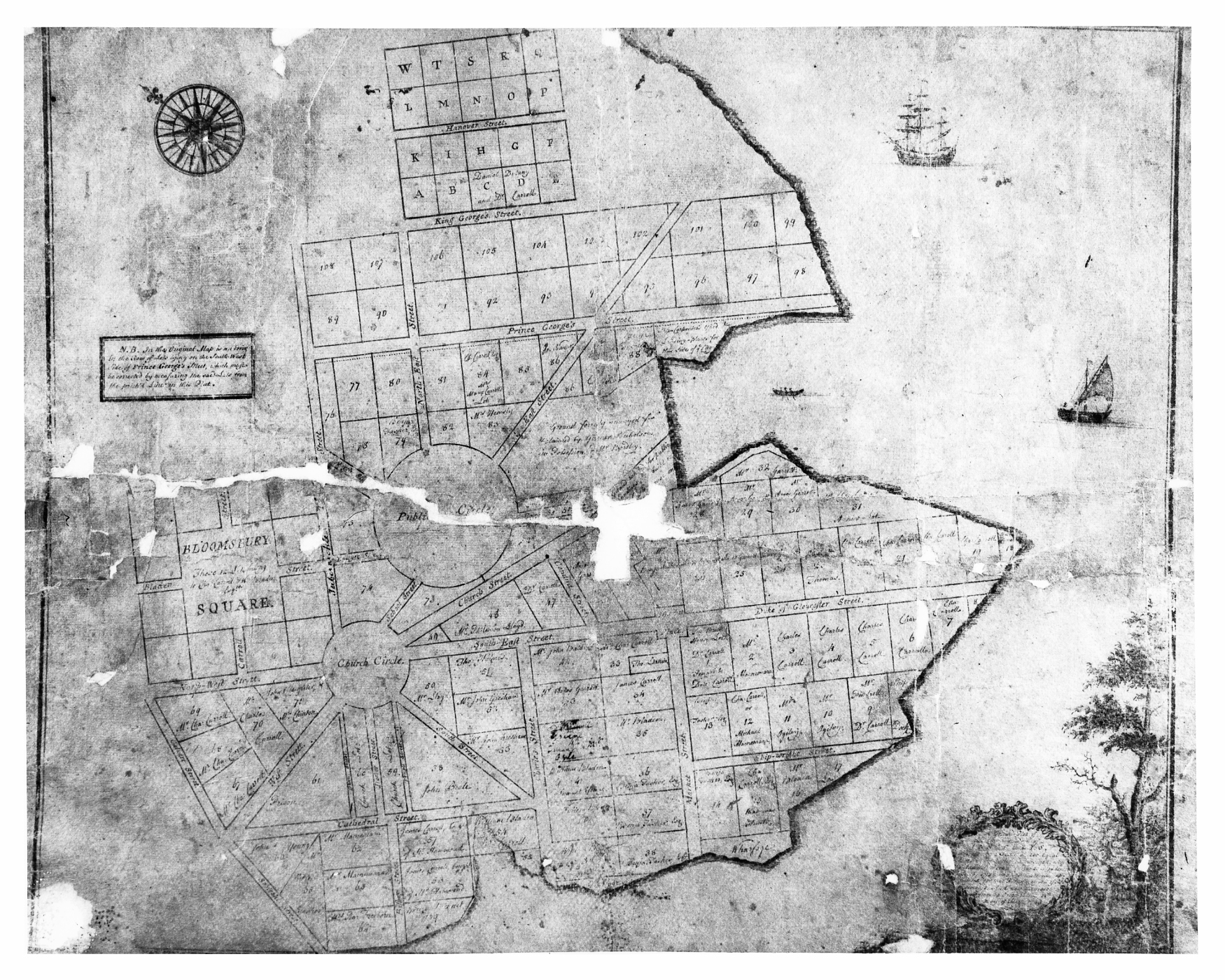 | 1,750 × 1,400 (1.68 MB) | C-tompkins (talk | contribs) | James Stoddert, A ground plat of the city and port of Annapolis, copy of James Stoddert's map of 1718, 1718 [1743]. Maryland State Archives, Annapolis. |
You cannot overwrite this file.
File usage
The following 3 pages use this file: