Difference between revisions of "File:0586.jpg"
[http://www.nga.gov/content/ngaweb/research/casva/research-projects.html A Project of the National Gallery of Art, Center for Advanced Study in the Visual Arts ]
| Line 1: | Line 1: | ||
| + | <br> | ||
| + | Arsène Lacarrière-Latour, ''Plan of New Orleans the Capital of Louisiana'' (1720), in Thomas Jefferys, ''A general topography of North America and the West Indies. Being a collection of all the maps, charts, plans, and particular surveys, that have been published of that part of the world, either in Europe or America'' (London: R. Sayer, 1768). Geography and Map Division, Library of Congress, Washington, D.C. | ||
Latest revision as of 16:15, March 28, 2018
Arsène Lacarrière-Latour, Plan of New Orleans the Capital of Louisiana (1720), in Thomas Jefferys, A general topography of North America and the West Indies. Being a collection of all the maps, charts, plans, and particular surveys, that have been published of that part of the world, either in Europe or America (London: R. Sayer, 1768). Geography and Map Division, Library of Congress, Washington, D.C.
File history
Click on a date/time to view the file as it appeared at that time.
| Date/Time | Thumbnail | Dimensions | User | Comment | |
|---|---|---|---|---|---|
| current | 16:08, March 28, 2018 | 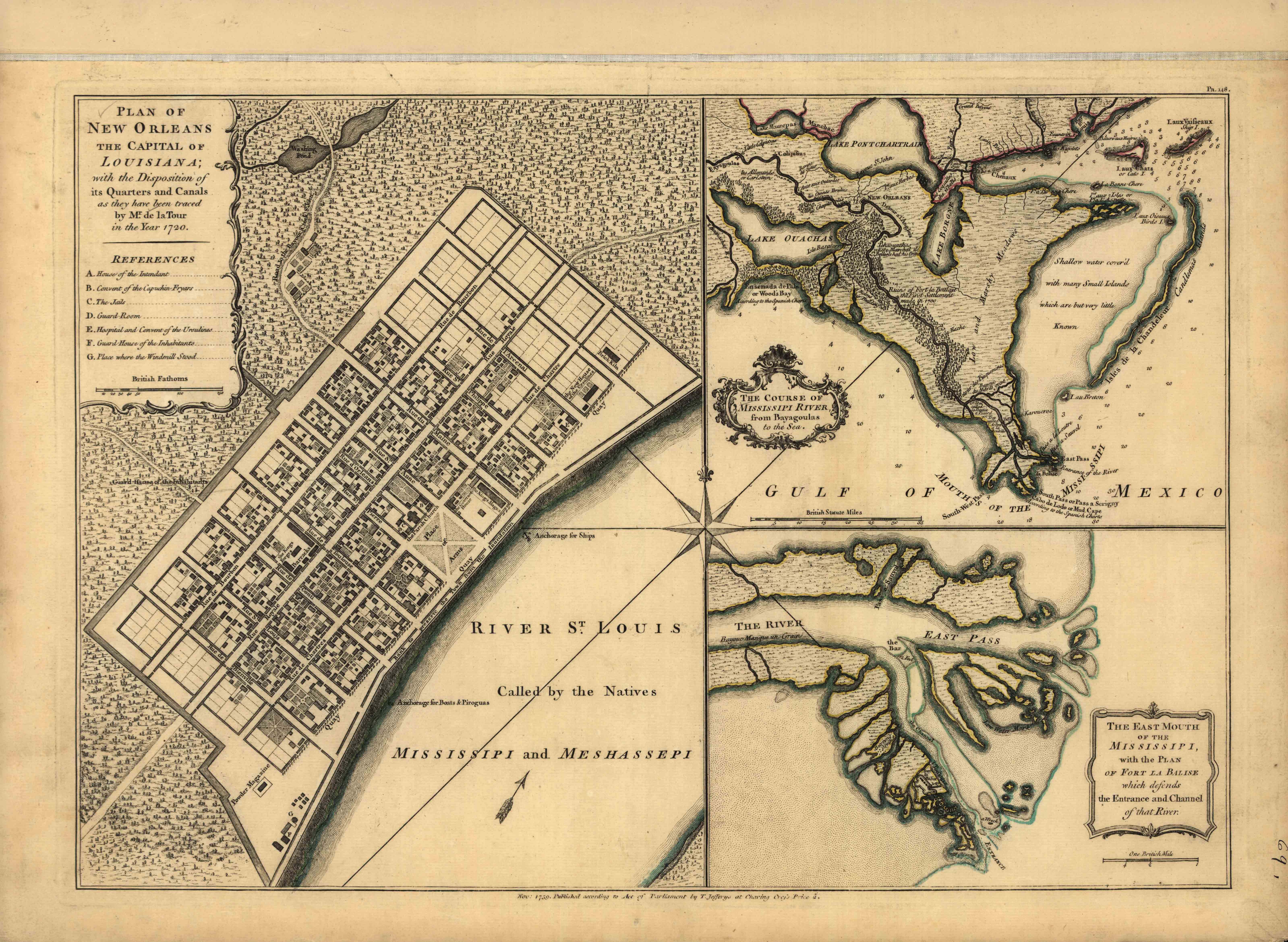 | 6,396 × 4,678 (1.63 MB) | C-cole (talk | contribs) |
You cannot overwrite this file.
File usage
There are no pages that use this file.