File:0570.jpg
[http://www.nga.gov/content/ngaweb/research/casva/research-projects.html A Project of the National Gallery of Art, Center for Advanced Study in the Visual Arts ]
Size of this preview: 740 × 599 pixels. Other resolutions: 741 × 600 pixels | 2,899 × 2,348 pixels.
Original file (2,899 × 2,348 pixels, file size: 1.63 MB, MIME type: image/jpeg)
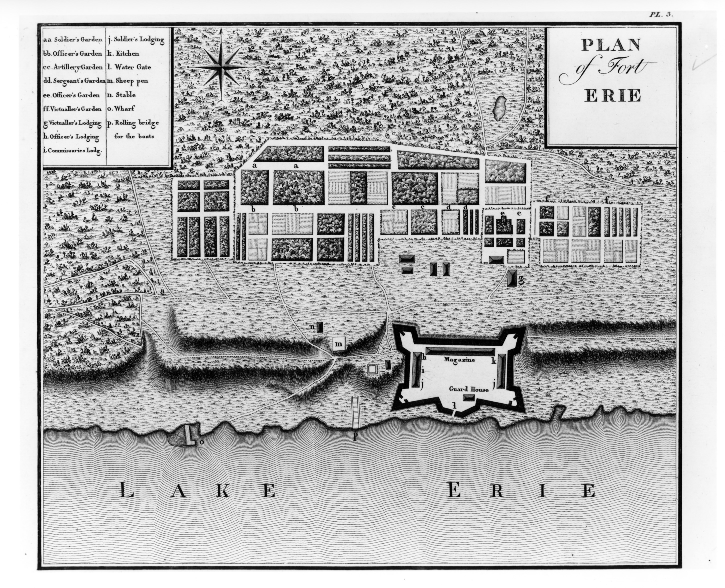
Georges-Henri-Victor Collot, Plan of Fort Erie, in Voyage dans l'Amérique Septentrionale. Paris: A. Bertrand, 1826. Geography and Map Division, Library of Congress, Washington, D.C.
File history
Click on a date/time to view the file as it appeared at that time.
| Date/Time | Thumbnail | Dimensions | User | Comment | |
|---|---|---|---|---|---|
| current | 14:49, March 28, 2018 | | 2,899 × 2,348 (1.63 MB) | C-cole (talk | contribs) |
You cannot overwrite this file.
File usage
The following 4 pages use this file: