File:2257.jpg
[http://www.nga.gov/content/ngaweb/research/casva/research-projects.html A Project of the National Gallery of Art, Center for Advanced Study in the Visual Arts ]
Size of this preview: 697 × 600 pixels. Other resolution: 1,999 × 1,720 pixels.
Original file (1,999 × 1,720 pixels, file size: 846 KB, MIME type: image/jpeg)
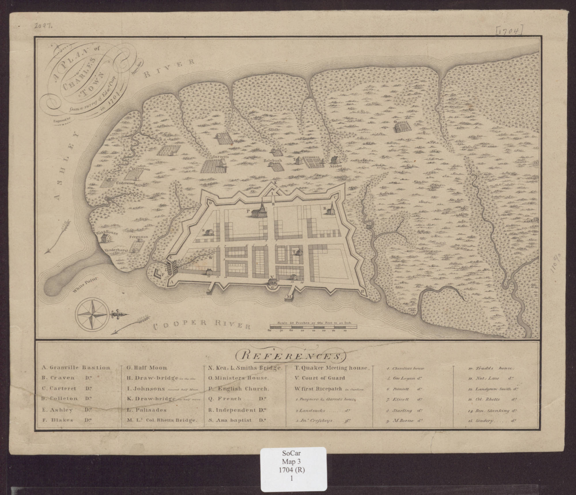
Edward Crisp (surveyor), James Akins (engraver), "Plan of Charles Town from a survey by Edward Crisp in 1704 [1809]", map, 23 x 29 cm. Courtesy of South Caroliniana Library, University of South Carolina, Columbia, S.C.
File history
Click on a date/time to view the file as it appeared at that time.
| Date/Time | Thumbnail | Dimensions | User | Comment | |
|---|---|---|---|---|---|
| current | 19:46, June 23, 2020 | | 1,999 × 1,720 (846 KB) | A-Whitlock (talk | contribs) |
You cannot overwrite this file.
File usage
The following page uses this file: